Real-time 3D Inspections with Apple Vision Pro
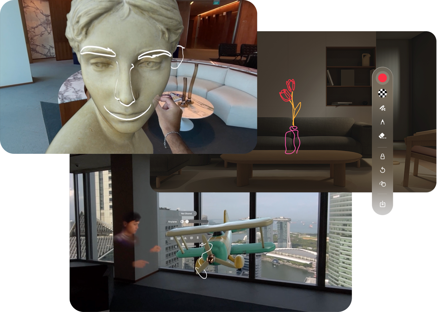
Spatial Plan transforms the way you perform inspections, allowing you to add drawings, annotations, voice memos, measurements, and more to any physical space and share the result with anyone.
Discover the potential of Spatial Plan.
Real-time Inspection
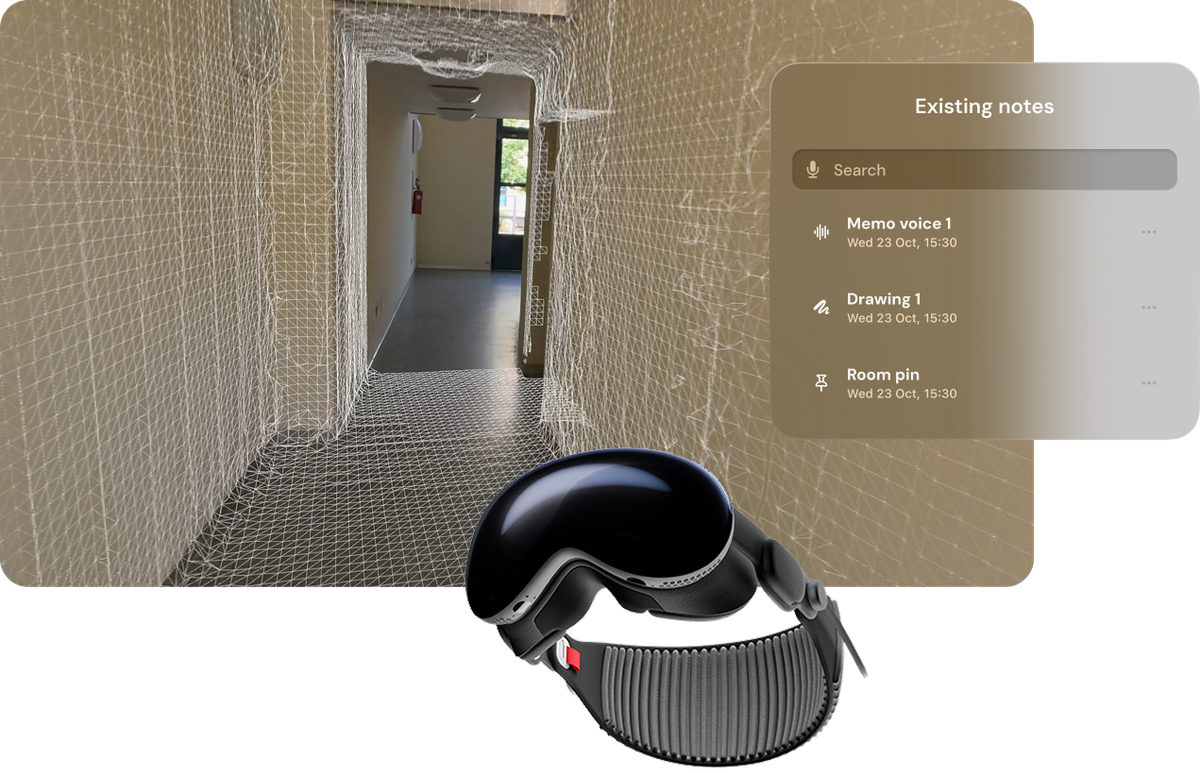
Wearing Apple Vision Pro, you can inspect the environment simply by looking around.
Immersive Tools
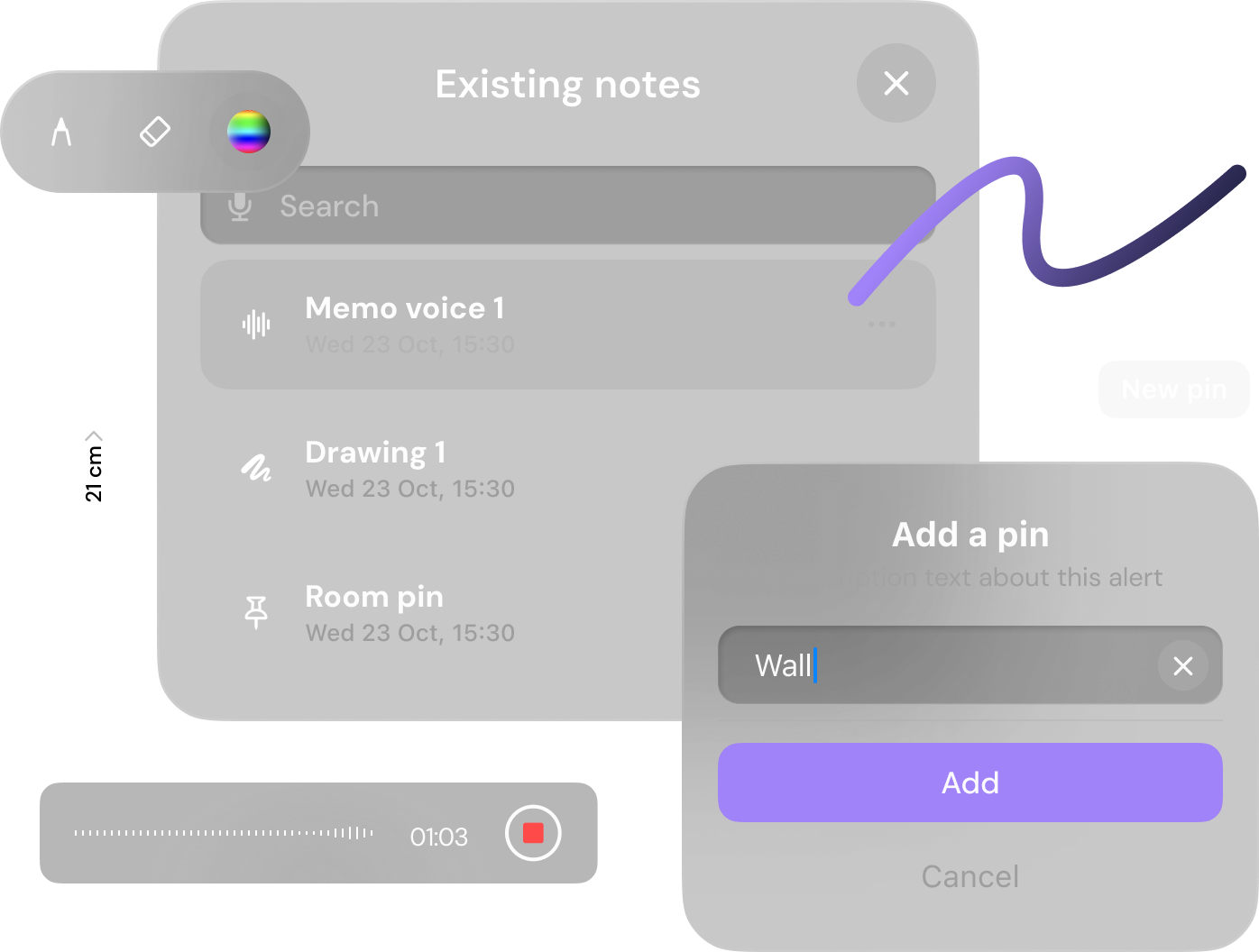
Notes and comments can be added on the spot with Spatial Drawing, pins, voice memos, and measurements throughout the inspection.
Instant Collaboration
Export and share inspections instantly, improving collaboration with technicians, clients, and stakeholders.
Capture, annotate, export: that's all.
Step 1 - Scan the environment
Thanks to Apple Vision Pro's LiDAR sensors, the surrounding environment is scanned in real-time, creating a virtual 3D model that perfectly overlays the real scene. All in real-time!
Step 2 - Perform the inspection
Add notes, voice memos, take measurements, add drawings and annotations, and generate 3D models and floor plans automatically.
Step 3 - Export and share
Once the inspection is complete, you can download or share the annotated 3D environment with colleagues or stakeholders, or simply share the web link.
Work anywhere.
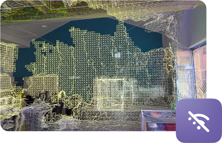
Spatial Plan works even without an internet connection: this ensures continuity of operations even in environments where connectivity is limited or absent.
You can save inspections locally on the device and automatically sync them with the Cloud as soon as an internet connection is available. This way, your data is always safe and accessible from any other device connected to your account.
A complete set of tools.
All the features you need are always available in the palm of your hand.
Spatial Plan provides an intuitive toolkit that allows you to capture, annotate, and measure your environment with precision. Whether you need to add detailed notes, create visual annotations, or take accurate measurements, every tool is designed to enhance your inspection workflow.
Export in 3D format.
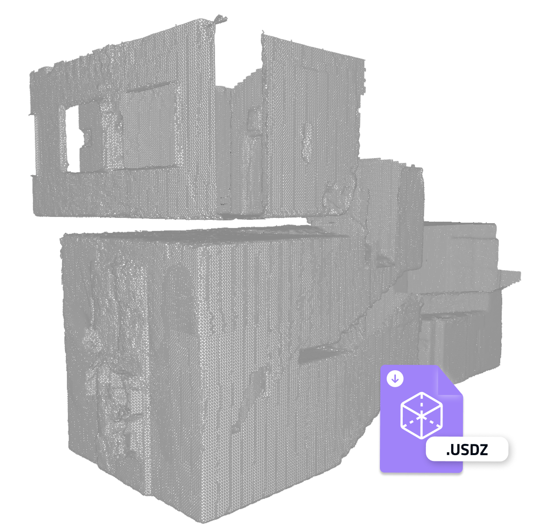
Spatial Plan allows you to export the 3D model of the inspected environment in USDZ format.
USDZ files can be opened on any Apple device (iPhone, iPad, Mac, Apple Vision Pro) or viewed within our dedicated web viewer.
An ecosystem of integrations.
Spatial Plan is part of an ecosystem of applications developed by dilium.
Seamlessly connect Spatial Plan with our suite of complementary tools to unlock the full potential of Apple Vision Pro. From generating photorealistic 3D models to immersive portals, our integrated ecosystem transforms how you capture, analyze, and share information.
Integrate Spatial Plan into your workflow
With the Enterprise plan, you get access to Apple's Enterprise APIs that allow you to access advanced features to integrate Spatial Plan into your company's journey.

Camera access
Full access to Apple Vision Pro camera features for high-resolution captures and saving photos/videos directly from the headset.

AI analysis
Leverage artificial intelligence for automatic anomaly detection during inspections.
YOLO / ML Pipeline
Integrate custom machine learning models for object recognition and defect detection.
Streaming and remote collaboration
Enable real-time streaming and remote collaboration for group inspections and remote supervision.
Spatial Plan for every sector
Discover how Spatial Plan can be used in different professional sectors:

Maintenance and facility management
Simplify inspections of buildings, plants, and infrastructures, reducing time and costs.

Inspections and insurance
Document damage and verify compliance with safety regulations with precision and speed.

Museums and cultural heritage
Document and preserve cultural heritage and archives accessible to everyone.

Road accidents and incidents
Document accident scenes in detail, accelerating investigations and insurance procedures.
Traditional inspections are slow, expensive, and error-prone

-30%
Cost Reduction

-50%
Disputes

+40%
Faster Inspections
*Source: McKinsey & Company and Zurich Insurance
Choose the plan that's right for you
Free Plan
- 3D Environment Scanning (Basic - limited scans)
- Immersive Annotations
- Web Project Management (1 project)
- Web Viewer
- 3D Model Export
- Advanced Technical Support
- Access to Camera Features
- Cloud Sync CDN
- Enterprise Security & Compliance (GDPR, ISO 27001)
- Training & Workshops
- SSO
- Streaming Remote View
- Multi-tenant Access
- Remote Collaboration
- Predictive Analysis with AI
- API Integration (CRM/ERP/CMS)
- Custom Branding / White Label
- Machine Learning Engine (YOLO / ML pipeline)
Personal Plan
- 3D Environment Scanning (Unlimited local scans)
- Immersive Annotations
- Web Project Management (Unlimited projects)
- Web Viewer
- 3D Model Export (USDZ)
- Advanced Technical Support (Email support)
- Access to Camera Features
- Cloud Sync CDN
- Enterprise Security & Compliance (GDPR, ISO 27001)
- Training & Workshops (Optional add-on)
- SSO
- Streaming Remote View
- Multi-tenant Access
- Remote Collaboration
- Predictive Analysis with AI
- API Integration (CRM/ERP/CMS)
- Custom Branding / White Label
- Machine Learning Engine (YOLO / ML pipeline)
Enterprise Plan
- 3D Environment Scanning (Unlimited with enterprise-grade optimization)
- Immersive Annotations (Advanced - multi-user, versioning, audit trail)
- Web Project Management (Unlimited projects with role-based access)
- Web Viewer
- 3D Model Export (Extended formats + custom integrations)
- Advanced Technical Support (Dedicated Slack channel)
- Access to Camera Features (Full access with enterprise Apple certificate)
- Cloud Sync CDN (Enterprise CDN sync)
- Enterprise Security & Compliance (SSO, GDPR, ISO 27001, audit logs)
- Training & Workshops (Included - tailored sessions for teams)
- SSO
- Streaming Remote View
- Multi-tenant Access (Organization-level management)
- Remote Collaboration (Multi-user, cross-department)
- Predictive Analysis with AI (Advanced ML models)
- API Integration (CRM/ERP/CMS) - Full API access
- Custom Branding / White Label
- Machine Learning Engine (YOLO / ML pipeline)
Testimonials
A success story
Spatial Plan has revolutionized the way we document our collections. Now we can create detailed 3D archives and share them with researchers from all over the world.

Ligurian Archaeological Museum
Genoa
Frequently Asked Questions
Spatial Plan is designed to work with Apple Vision Pro.
Why choose Spatial Plan
dilium
Spatial Plan is developed by dilium, an innovative Italian SME since 2017 specialized in Spatial Computing (AR/VR) and computer vision (AI) solutions.
Experience from the start
We've been working on projects leveraging Emerging Technologies, such as Spatial Computing, to drive digital evolution of B2B and B2C channels since 2017.
Selected by Apple
We were selected by Apple in September 2023 to participate in Developer Labs dedicated to Apple Vision Pro in London and Cupertino.
Technical expertise
We've been working with Emerging Technologies since 2017, developing a rich and diversified know-how acquired over these years.
Contact our sales team today
dilium srl
Via Selvanesco 75, Milan, Italy
Spatial Plan was supported by the Tech Up Call - CTE Genova Project - Digital workshop for culture - CUP B37F23000000008 - PSC MISE 2014-2020 and was developed with the support of:


Spatial Plan was refinanced after winning the SI4.0 2025 Call from UnionCamere and CCIA of Milan


